The Ultimate Hiking Guide to Mississippi-Palisades State Park
Local travel is the name of the game in 2020 and with autumn in full bloom, it seemed like the perfect time to migrate away from the bustling streets of Chicago and into the woods to soak up all of the colorful glory.
My alarm rang far too early at 5 am, but it was well worth the sleepless night as I rolled into an empty Mississippi-Palisades State Park at the crack of dawn, nestled along the northern section of the great Mississippi River and complete with sweeping views of Iowa across the way.
Picnic areas, grassy fields, and overlooks are in abundance within the 2,500 acre National Natural Landmark, but the goal of the day was to explore the trails and gain some much-needed elevation (I’m still adjusting to living in the midwest — shout out to the Wasatch Mountains back in Utah).
Here’s everything you need to know about hiking in Mississippi-Palisades State Park:
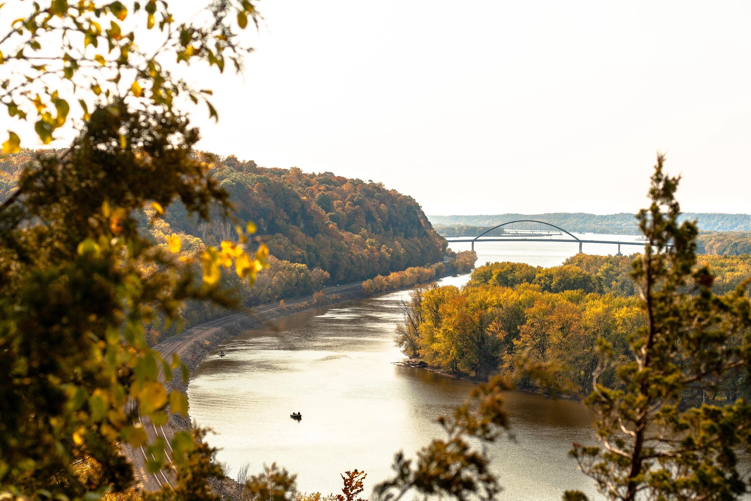
View of the Mississippi River as seen from the Sunset Trail at Mississippi-Palisades State Park
THE BASICS:
Location: Just north of Savanna, Illinois in Carroll County
Established: The park was founded in 1973
Trails: Hiking in the area is divided into the north and south systems, both containing 5 trails of their own for a cumulative 15-miles worth
Note: this post focuses on the southern trail system
Drive Time: 2 hours and 45 minutes from Chicago, depending on the time of day
Cost: FREE!
Facilities: Grills, gazebos, picnic areas, and restrooms can be found throughout the park
Why Mississippi-Palisades: The drive along the Great Northern Road as it pops in and out of small towns is just as stunning as the park itself, but there’s nothing quite like hiking up the bluffs and seeing the sweeping views above the Mississippi River in the peak of autumn
Difficulty: AllTrails rates this 4.6-mile multi-trail loop as ‘difficult’ due to a few sections of steeper terrain, but it’s a great combination of ascent, descent, and level ground. Plenty of families with young children were out and about
Great! Now that we’ve covered the basics, here’s how I spent my time wandering the southern trail system:
SUNSET TRAIL
I’d recommend starting with this trail as early as possible as the Lookout Point is by far the most popular overlook of the Mississippi River within the state park’s southern trail system. It’s here where you’ll soak up the sweeping views of the river and watch trains roll by below for as long as your heart desires.
The steepest part of the trail is departing from the parking lot as you climb the stairs and gain a quick chunk of elevation. Keep in mind that it’s a narrow, single-track dirt path with steep drop-offs to one side, so be on the lookout for other hikers and proceed with caution.
Once you reach the top of the bluff you’ll encounter a road that leads directly to the overlook. Do not head that way. Instead, cross over and continue on the trail. This winding path will take you down into a ravine thick with vegetation, complete with a wooden foot-bridge that’s set beneath a canopy of changing leaves.
As you make your way up and out of the trail’s low-point, you’ll stumble back onto the road and have the opportunity to scope the overlook. Pro tip: If it’s busy, continue south on the trail and you’ll find a separate, unofficial overlook with views downriver.
Sunset Trail in Mississippi-Palisades State Park
Don’t forget to pack these essentials!
SENTINEL TRAIL
Sentinel Trail is an easy 1.2-mile trail that is located directly across the road from the Sunset Trail, next to the picnic shelter and makes for a convenient second loop on the day.
As you cross the bridge and reach the fork, head left. This will take you up another set of wooden stairs and to a t-junction at which point you’ll choose left again. This will take you to an upper parking lot where you will pick up the less-trafficked Pine Trail.
After completing the short Pine Trail loop (see next section), head back up the Sentinel Trail path that led to the parking lot and continue straight past your previous left turn at the t-junction. This will take you back towards the Mississippi River and over to some last-minute views across the water before heading back down to the parking lot via stairs and narrow paths. Be sure to stop and check out some of the caves that have been carved into the side of the bluffs over the years!
Hiking through the narrow trails of Mississippi-Palisades State Park
PINE TRAIL
Pick up the Pine Trail once you’ve reached the upper parking lot after hiking part of the Sentinel. This was by far the least crowded path within the park, making it easy to avoid other hikers and find some serenity among the fall foliage.
After reaching yet another t-junction, head left. This will lead you out to a road in which you then follow to the right to pick up the trail again at the next parking lot.
As you start the ascent from the road you’ll immediately notice a gray spire affectionately known as The Sentinel. This is a popular rock climbing area so don’t be surprised if you run into some dare-devils as you make your way up to the next overlook before looping back into the woods and up to the Sentinel Trail.
In regards to peacefulness, fall foliage, and a great workout of ascending/descending paths, Pine Trail was the highlight of the day!
Fall foliage in Mississippi-Palisades State Park
There you have it; everything you need to know about hiking through Mississippi-Palisades State Park! The family-friendly area makes for a great day-trip from Chicago and it’s easy to turn it into a weekend getaway by continuing north along Route 84 up to Galena, a quaint town once home to Ulysses S. Grant.
Happy hiking!


